THE PROGRAM STRING
CANOPY IS THE DIAGRAM OF CONTOUR STRATEGY. PROGRAMS BRANCH.

CURRICULUM FOR AN URBAN PLANET LECTURE: URBAN THINK TANK
A must see lecture by A. Brillembourg + H. Klumpner. Gracias Prof. Vekstein.


THE 3 STAGED SYSTEM | 3 DIMENSIONS OF INTERVENTION | 3 DISCIPLINES
Architecturally, I propose gabion wall foundations which serve as stable platforms for architecture to grow (LINE). Urbanistically, I propose a series of covered civic spaces to foster identity among the Peruvian urban poor (PLANE). Landscape architecture stems from the proposition of harvesting and remediating greywater from public baths and laundries which feed bamboo farms intended for construction use (VOLUME). 3 disciplines are represented in a triad of homeopathic interventions on the impoverished hillsides of Lima. The first move was simple and elegant: add stairways for the people and recreation spaces for event. The next logical step is to weave the stairways with the programatic suture, guided by the architect and manifested by the citizen.
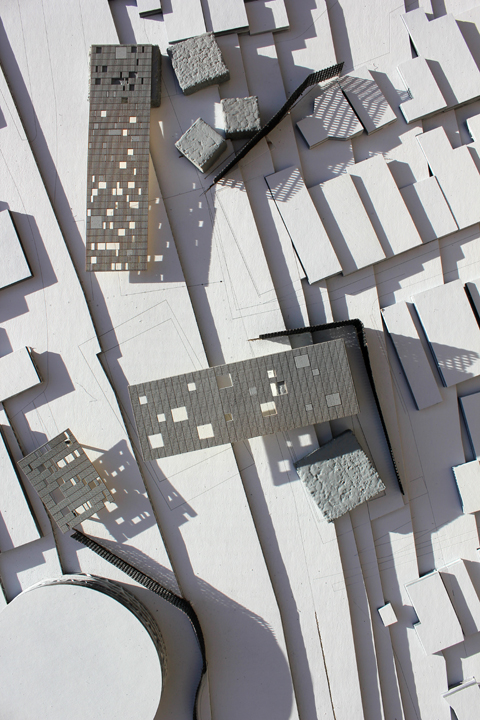
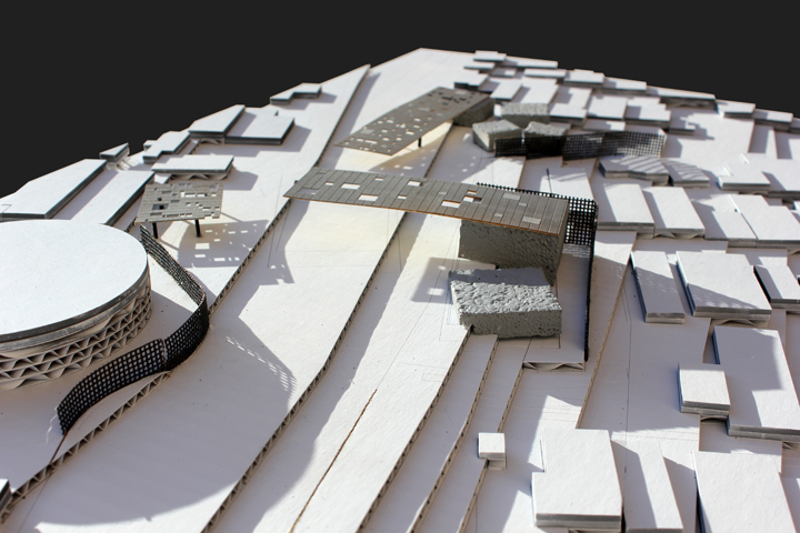
THE “HINGED PROGRAM” AND KIT-OF-PARTS
Today was studio. The Community Center form is too normative and needs to reflect a more “bold” approach. Thank you Claudio. I present the concept of “HINGED PROGRAMS”. A language is developing in which programs (STAIR + COMMUNITY CENTER or PLAZA + SOCCER FIELD or RESTOOM MEN + RESTROOM FEMALE) are fractured into two volumes hinged at the center. This cascades at “nested scales”. Street infrastructures (BENCH + PAVILLION are hinged upon a LIGHTPOST.

Programming + Surfaces
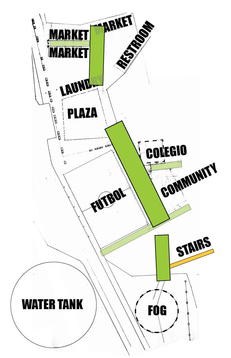
3 Infrastructures -ESCALERAS; CANCHA DE FUTBOL; TANQUE DE AGUA- are complemented by 3 Programs -LEARNING CENTER; MARKET; PLAZA.


ARCHITECTURAL SCOPE: EDUCATION AND MERCADO
Preliminary massing study of architectural scope. Learning Center + Market + Plaza + Futbol Field = NODULO_004 Topographic Suture.
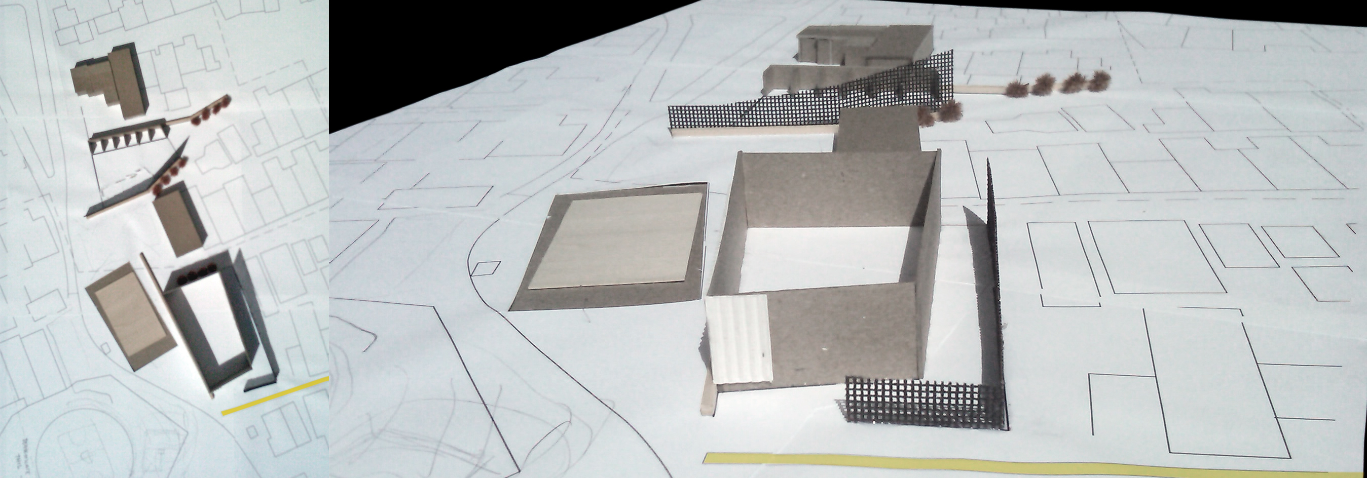


SCOPE OF WORK + STUDY AREA
A string of programs weaving stairways. Proyecto Sutura | Suture Project.


CREATING CONTOURS: GOOGLE EARTH TO RHINO
1. IMPORT GOOGLE EARTH AREAS INTO SKETCHUP.
2. TOGGLE TERRAIN ‘ON’
3. EXPORT 3D MODEL AS *.3Ds.
4. IMPORT INTO RHINO
5. SELECT SURFACE (IF MULTIPLE SELECT ALL SURFACES) AND ‘PATCH’ (FOR U AND Y TYPE 200)
5. DRAW VERTICAL LINE THROUGH HIGHEST POINT OF TOPOGRAPHY (TOGGLE B/W PLAN AND ELEVATION VIEWS TO CENTER.
6. TYPE ‘CONTOUR’ COMMAND (FOR BASE POINT CHOOSE BOTTOM OF VERT LINE, THEN SELECT TOP OF VERT LINE)
7. FOR INTERVALS CHOOSE DISTANCE DESIRED BETWEEN CONTOURS (I USE 10′ IN THIS CASE)

