Archive
Site Analysis: Ecotect Weather Tool v2
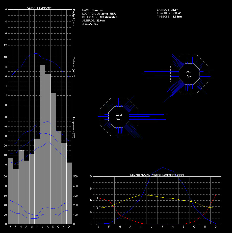
Here are some more useful diagrams pertaining to the wider Phoenix Metro area weather patterns. The data was recorded in 2003 most likely from Sky Harbor Airport. The weather file can be downloaded for free from http://www.ecotect.com/downloads/weatherdata although you will need an Ecotect license to run the analysis. The school labs have them. Enjoy.
-
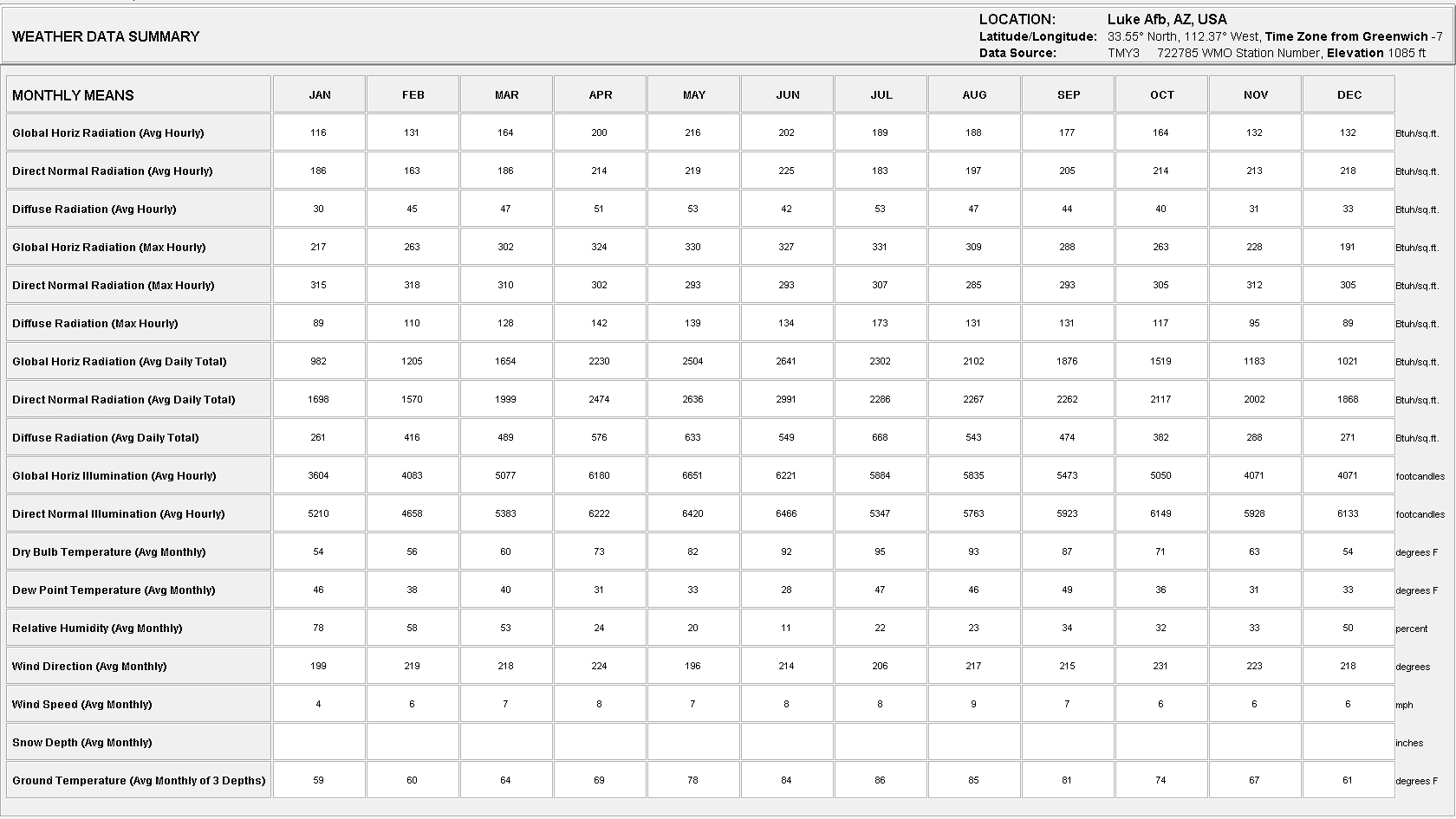
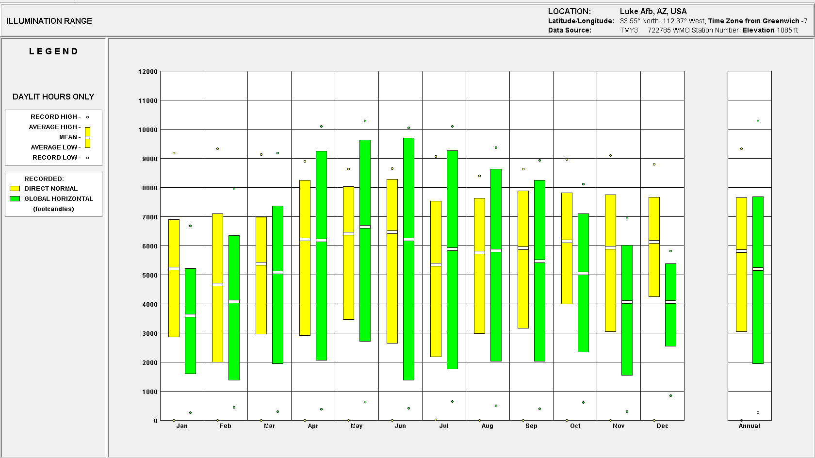
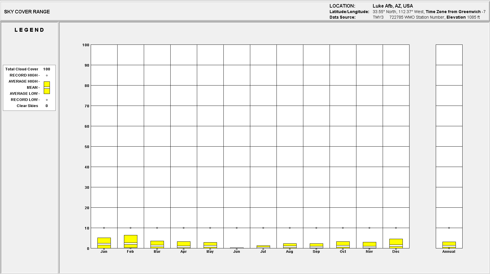
- Climate Summary
-
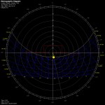
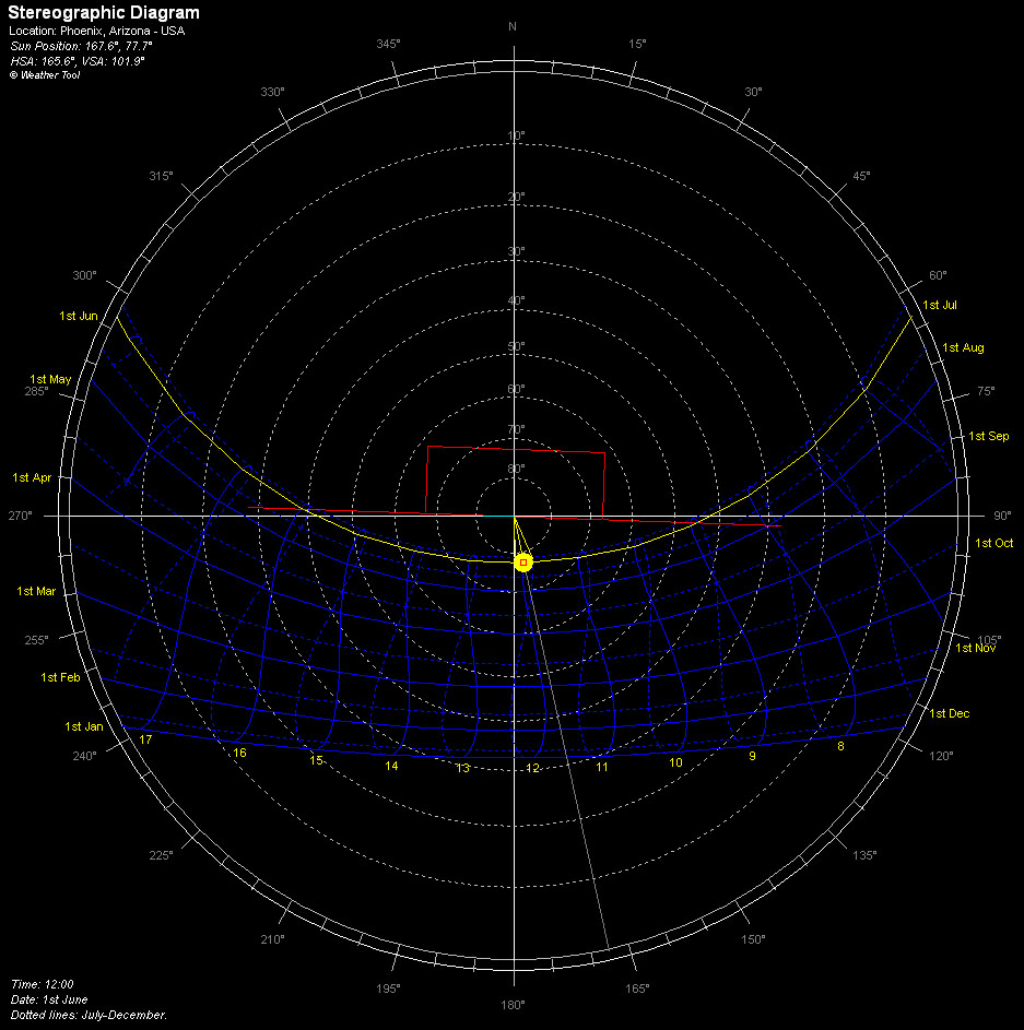
- Sun Chart: Summer Solstice
-
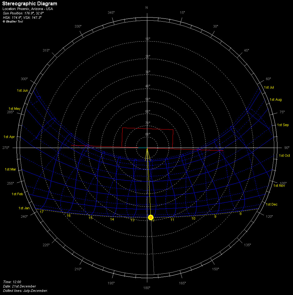
- Sun Chart: Winter Solstice
-
- Psychrometric Chart: Summer

-
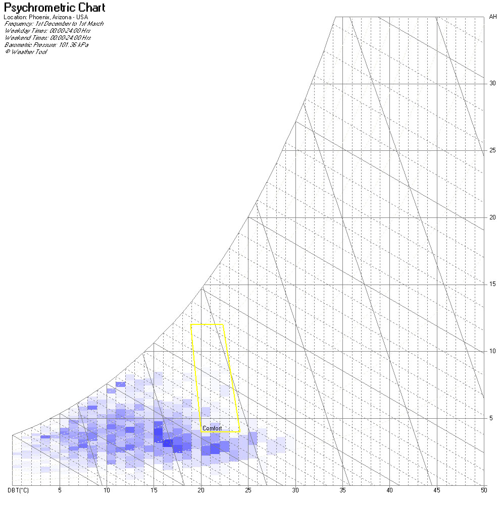
- Psychrometric Chart: Winter
-
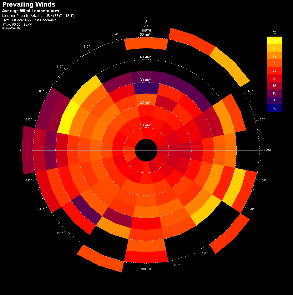
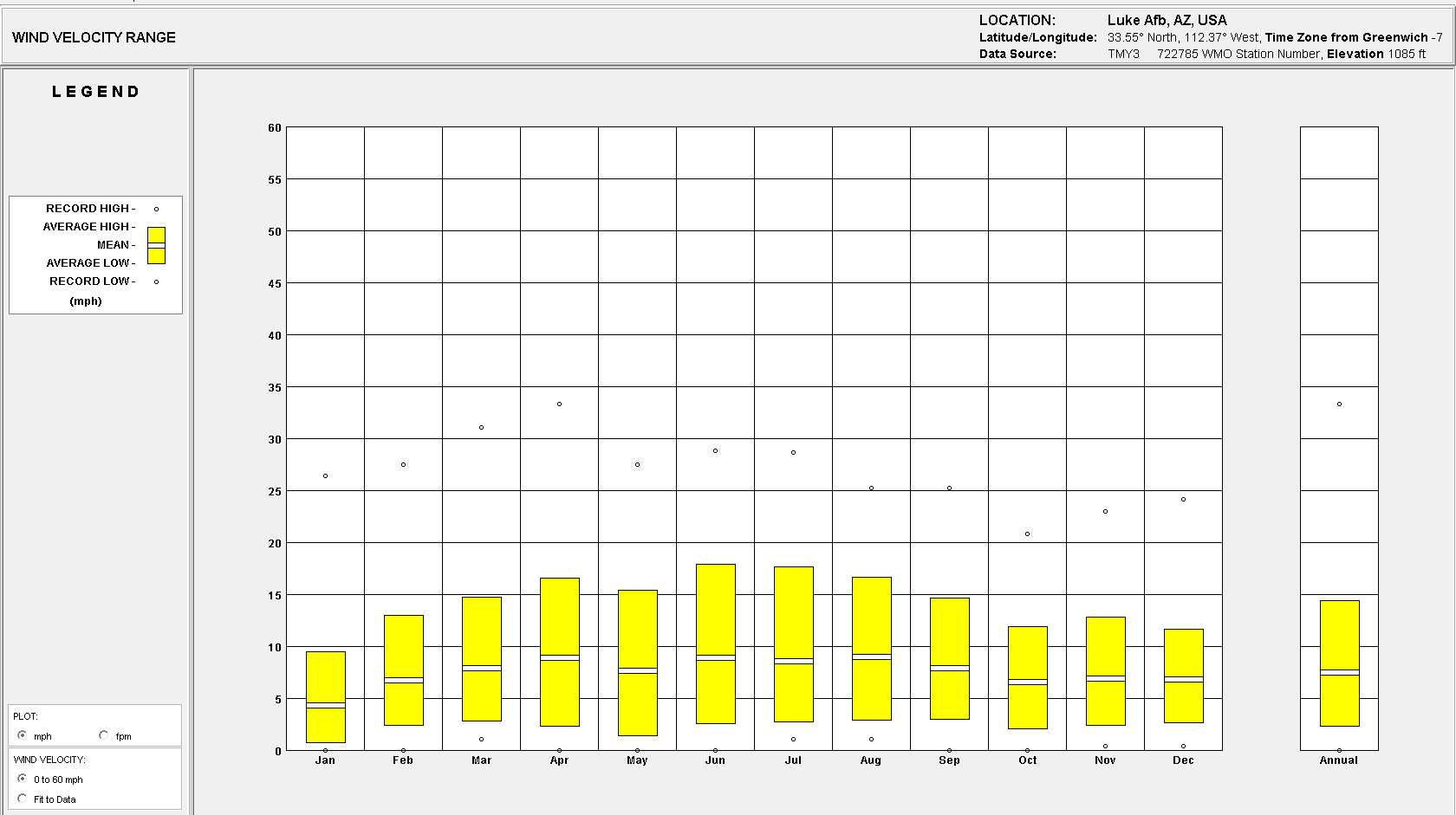
- Avg Wind Temperature
-
- Avg Relative Humidity
-

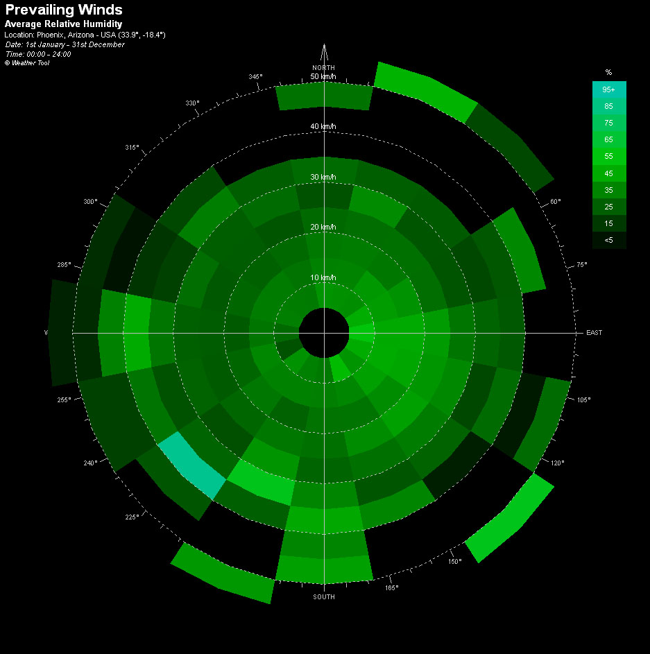
- Avg Rainfall
-

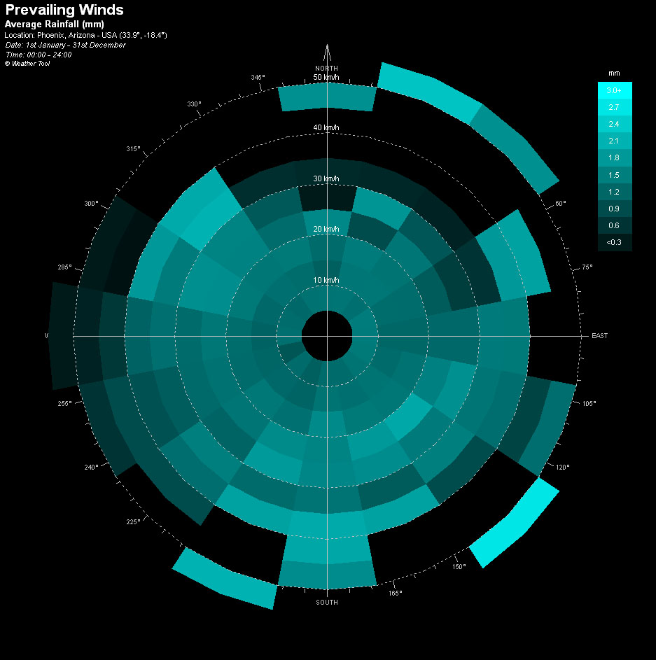
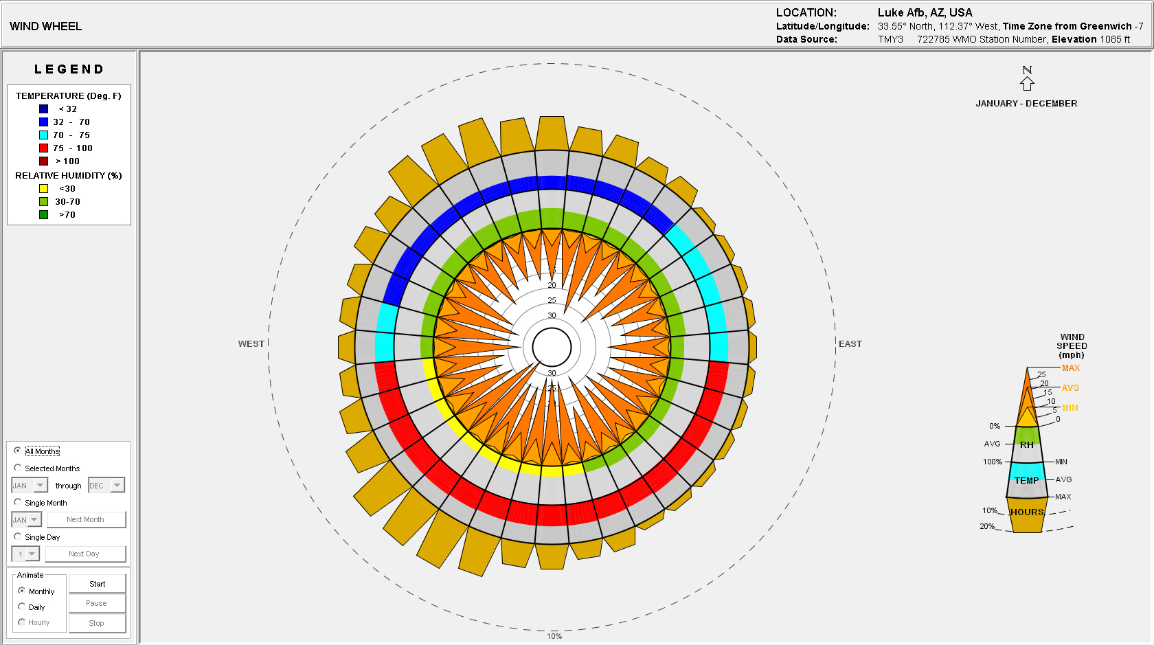
- Wind Frequency
Site Analysis: Climate Consultant 4.0
The .epw file is based on Luke Airforce Base which is located approx. 10 miles west of the proposed site location.


Site Analysis: Historical Aerials


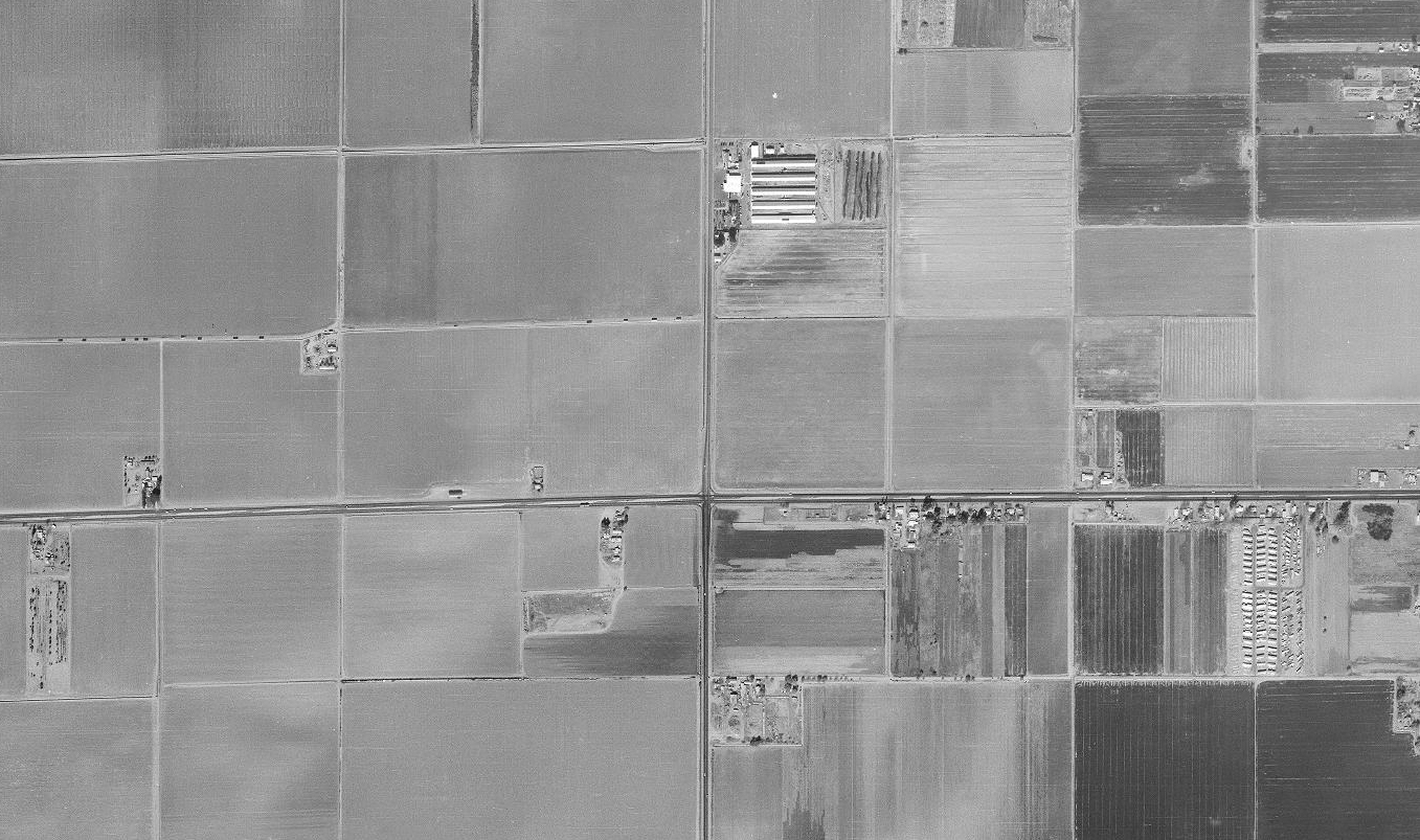
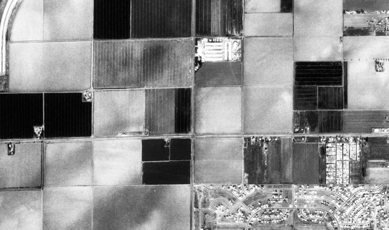

Obtained from Maricopa County GIS Services Website.
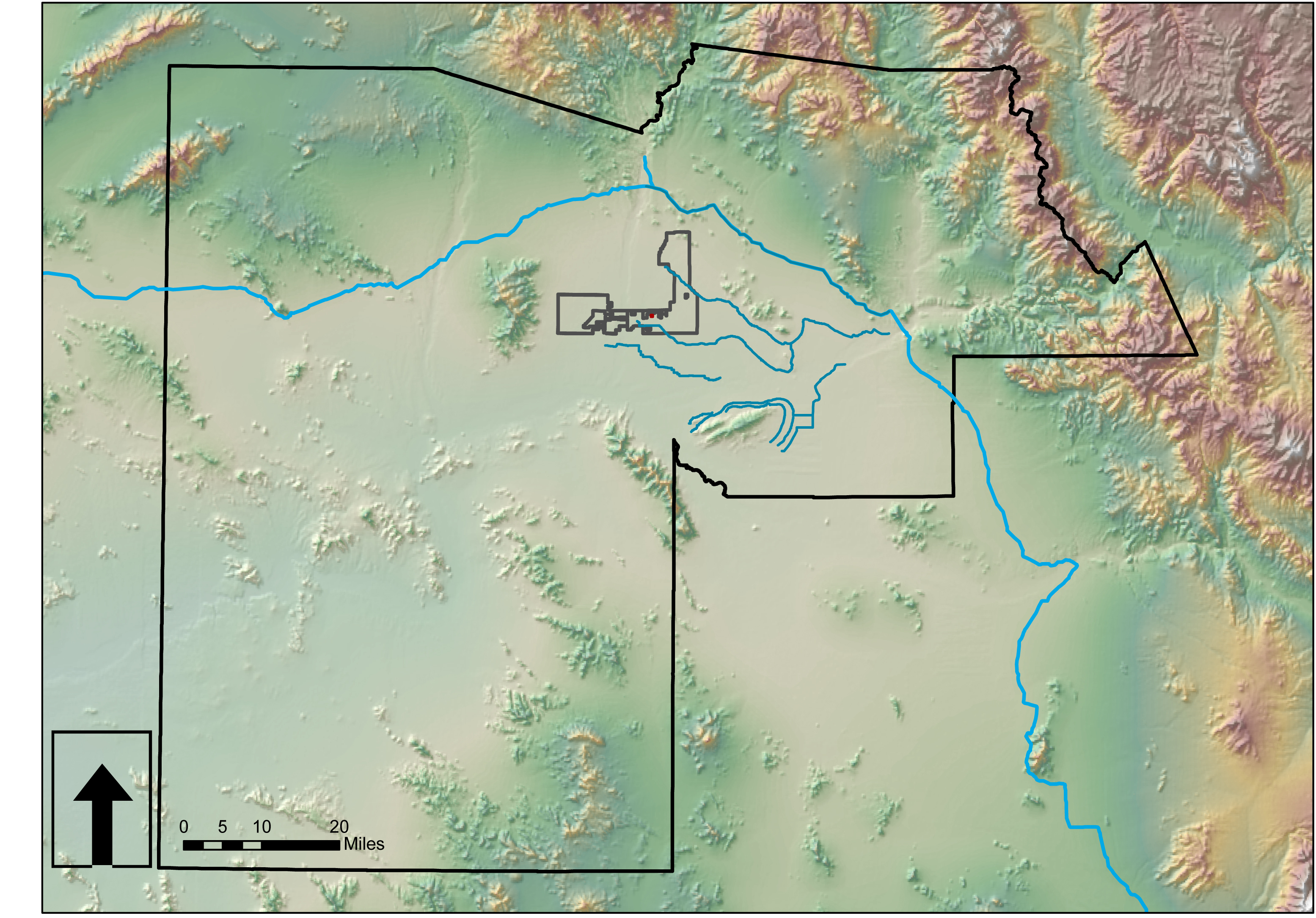
Preliminary Site Analysis: A GIS Survey

Much of the county data is available for download from Maricopa.gov. Look to their GIS services. Perhaps one exists for Pinal County? Below are some context maps of the proposed site location within Glendale. Lastly, I have imported GIS data (.shp files) into AutoCAD Map3D then into SketchUp to begin working on a 3D site model using Google Earth imported images. This takes about an hour from start to finish.