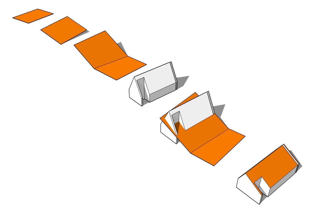
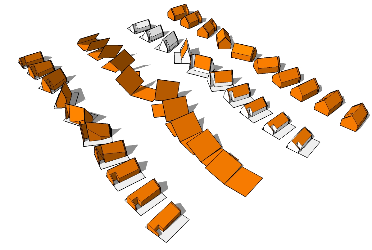
Sun Angle Parametrics: The Tilted Roof
As discussed, there are a variety of manners in which the path of the sun could be used to inform the design of the building massing. In the first configuration of 10 homes, each form is the same yet they are rotated according to the angle of the sun on the horizon. In the second scheme, each roof tilts with regard to the sun’s azimuth angle. Lastly, both the sun angle and azimuth are combined to warp the shape of each housing unit. The results are unique homes rooted in the movement of the sun on the Summer Solstice.


The reinjection of agriculture to the ‘Burbs’
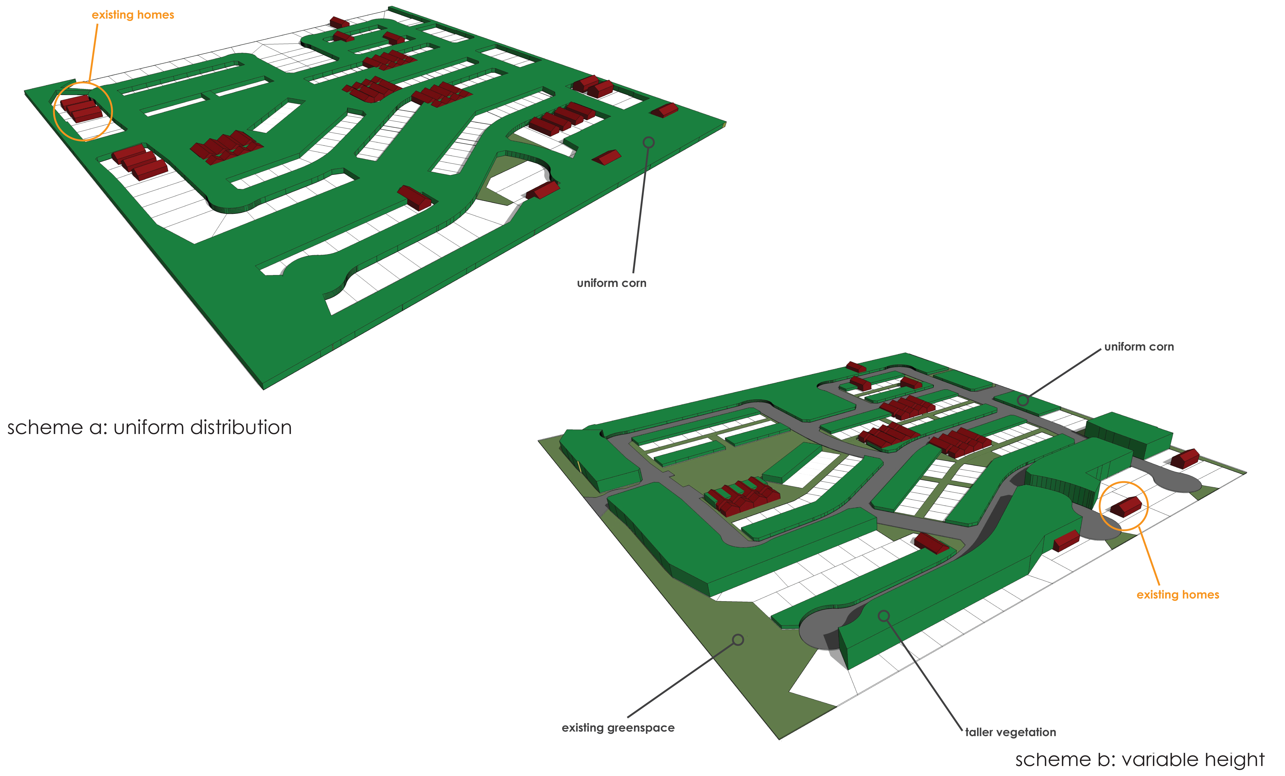
Question: if one is to pursue a route of reintroducting agriculture as a means of subsistance within an intimate community, then where are the most viable locations for this to develop? This parallels closely with what Jackie is proposing concerning an agriculturally focused site program. I am exploring (through the use of general massing experiments) the idea of planting higher vegetation on the south, west, and east sides of the subdivision in order to cool the core. These diagrams are the preliminary outcomes of the study.


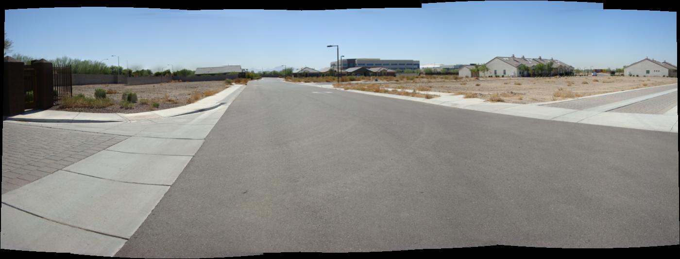
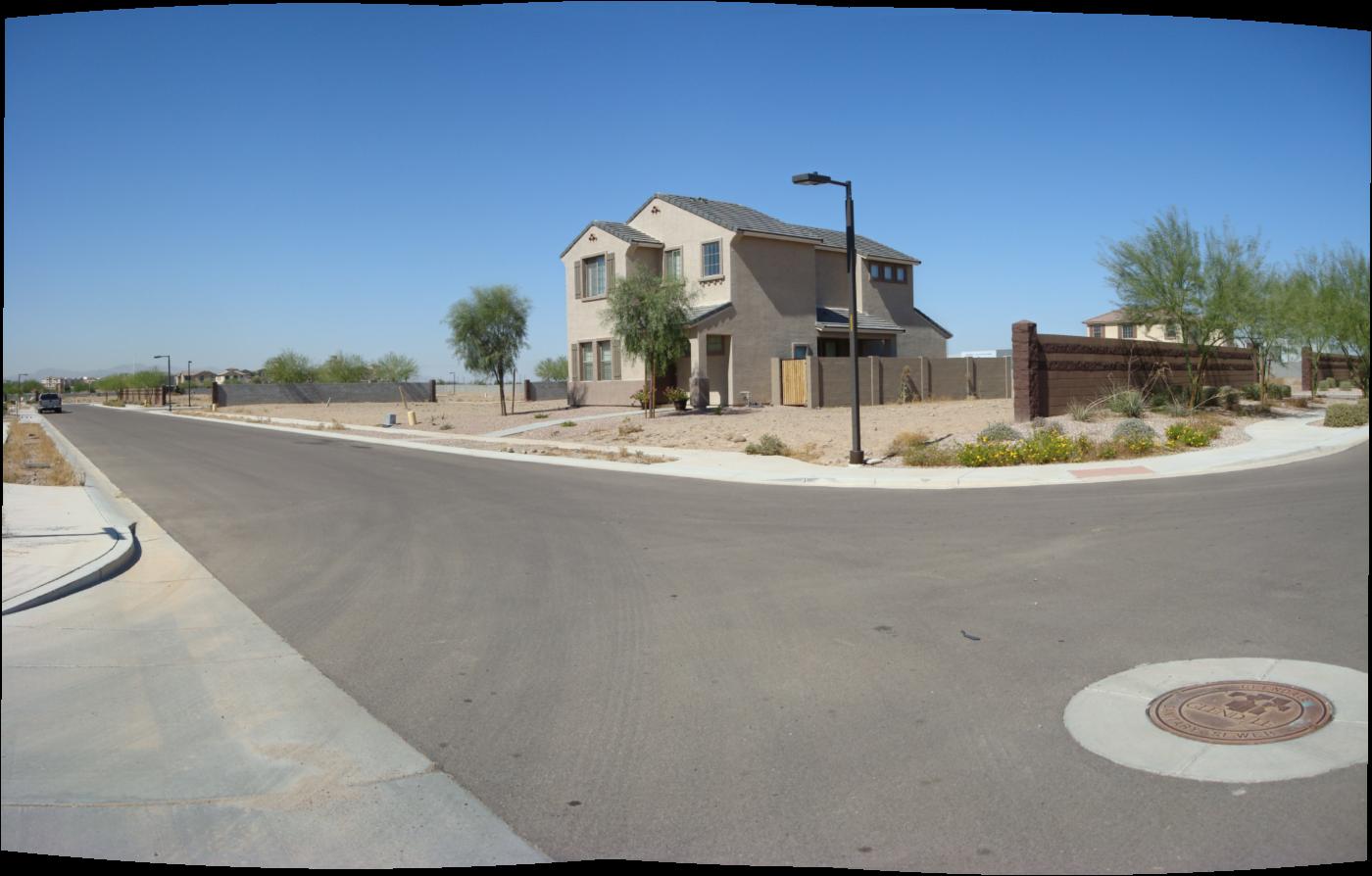
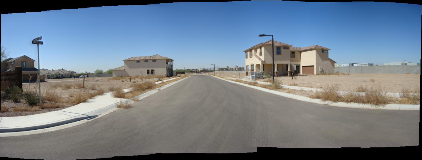
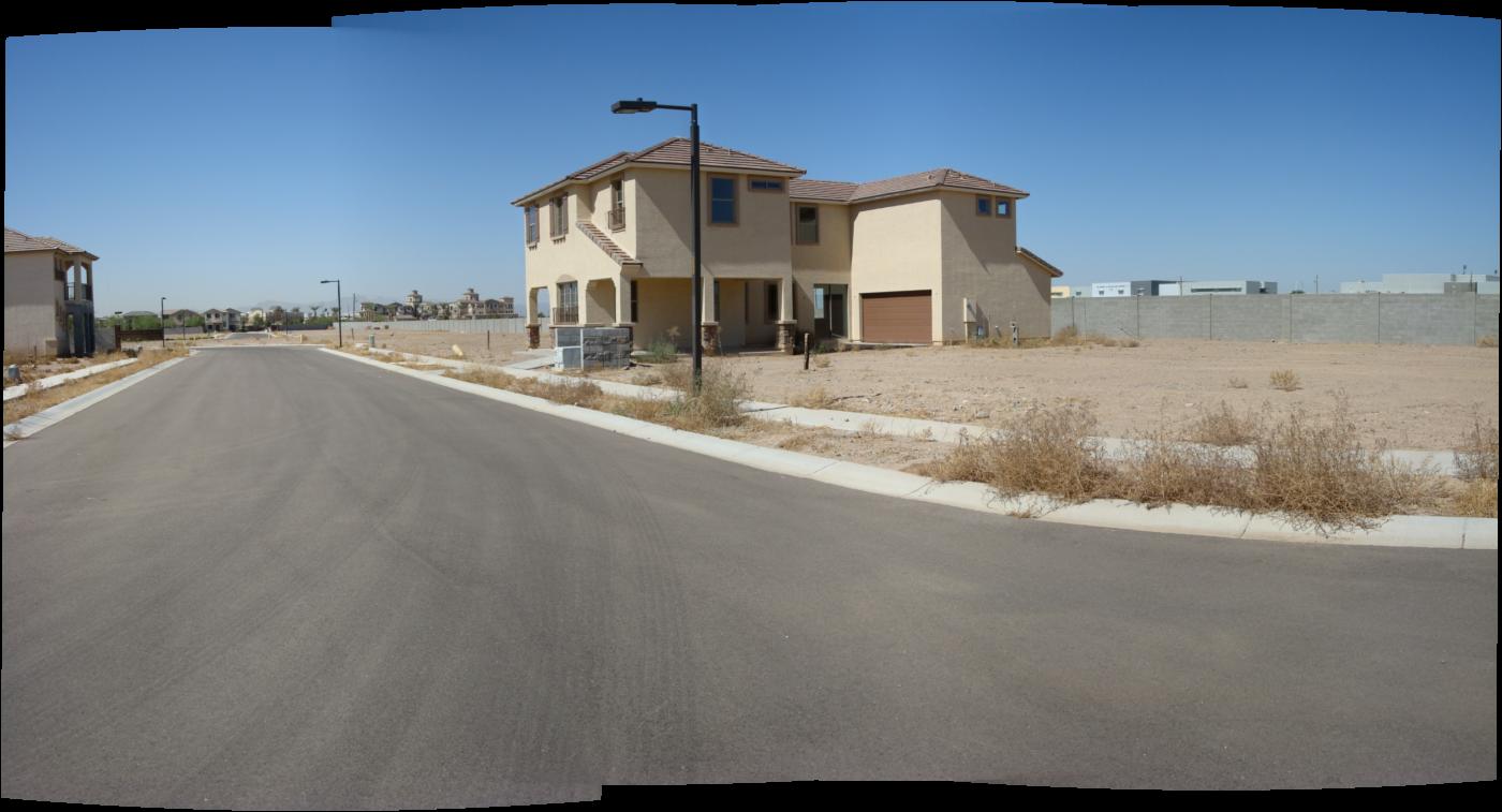
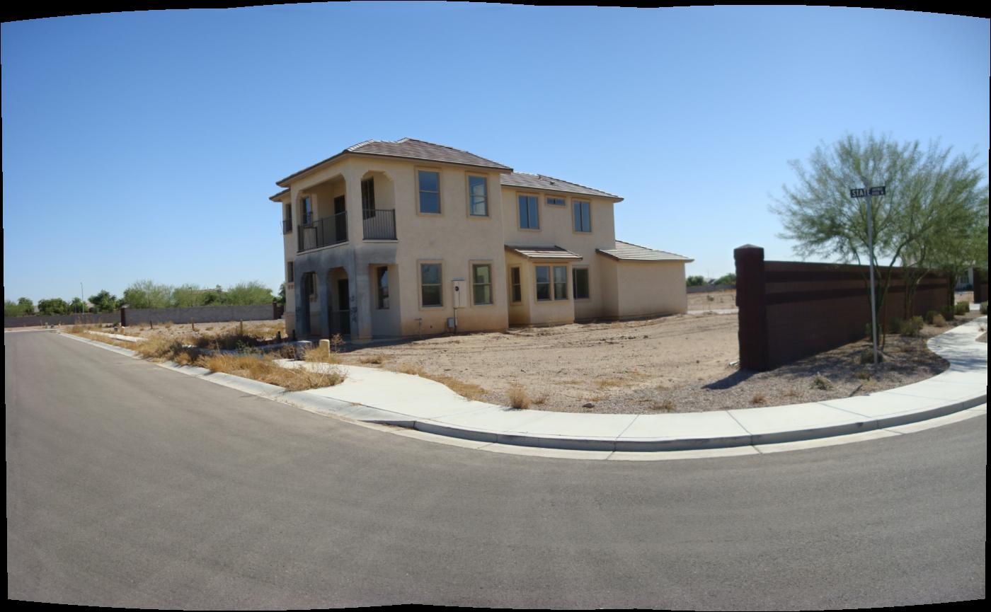
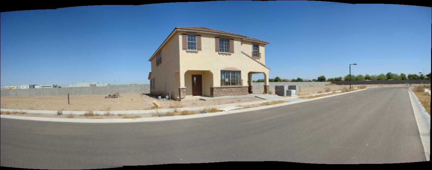
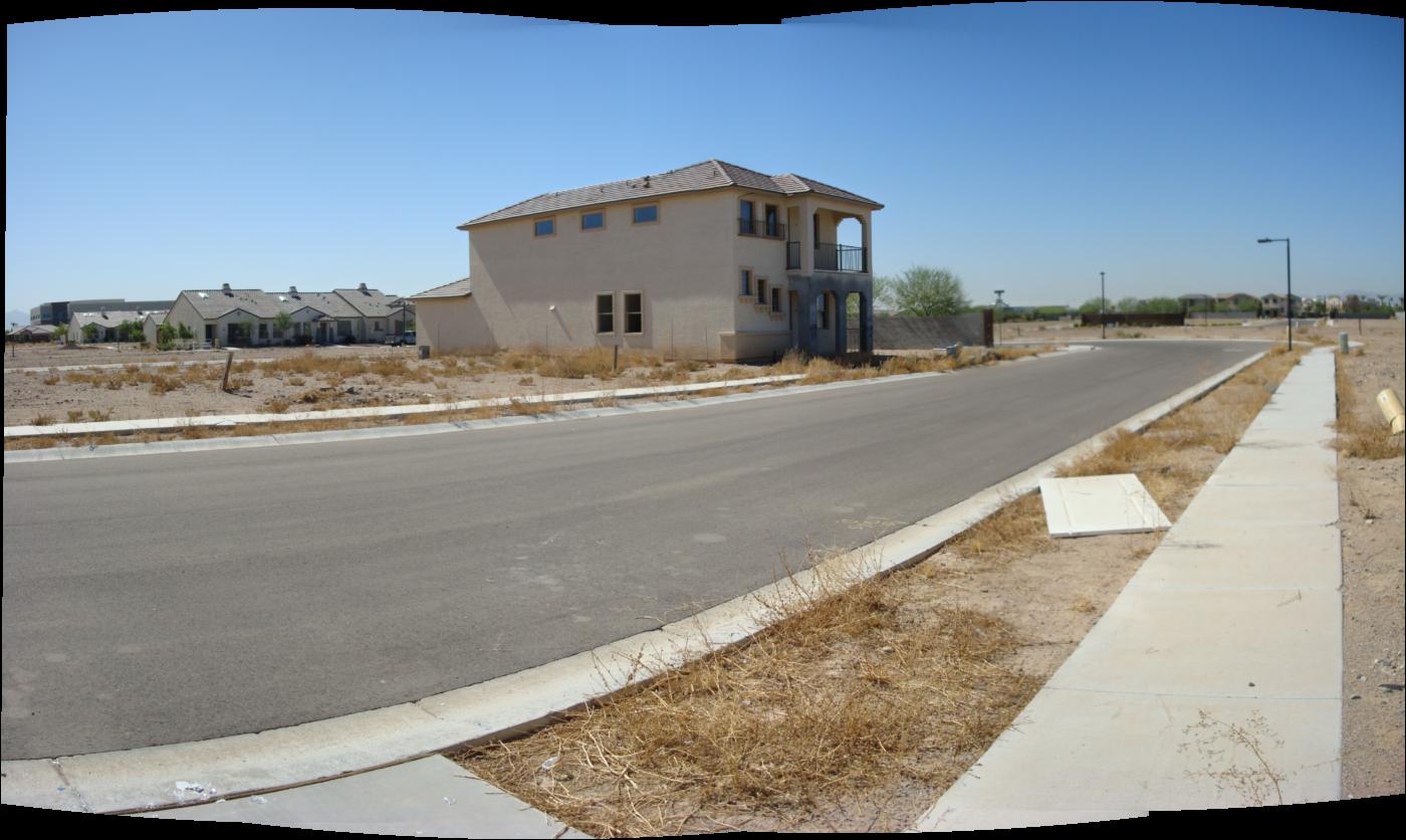
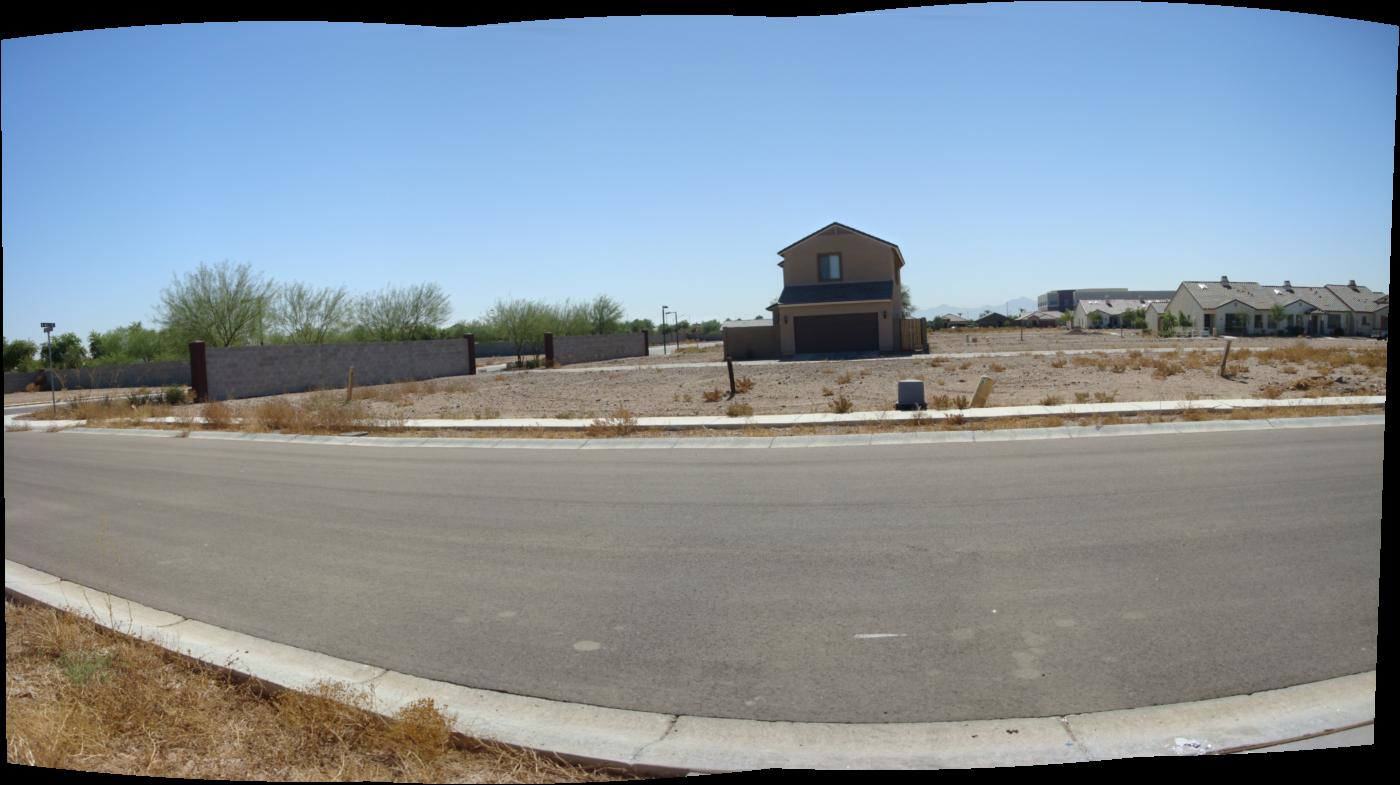
Site Photos: The Dotted Exurb
A landscape dotted with incomplete homes…


The Self-Sustaining Subdivision: Reviving Exurbia
What if we plant in the streets? These ideas were kicked around in Reburbia and what I had envisioned was a scenario in which abandoned lots became common areas for the growth of food and unfinished homes would serve as silos to house the annual harvest. But what about a more delitarious scenario whereby the housing crisis is never solved and all infrastructure collapses. A social experiment in which neighbors once ambivalent towards one another are forced to cooperate in order to survive in a harsh environment. How can humans reclaim their surroundings and adapt in the arid desert of Metro Phoenix?

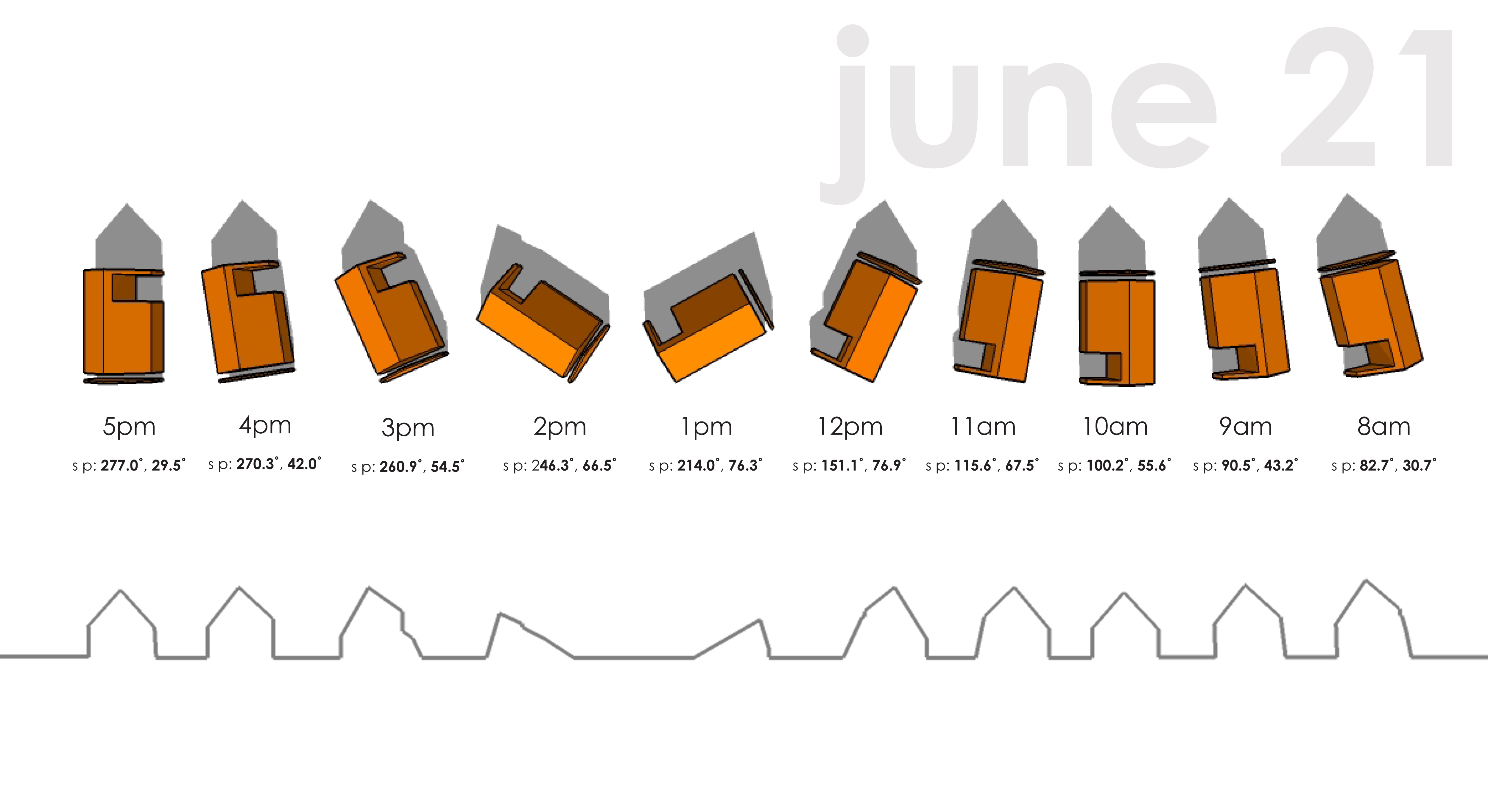
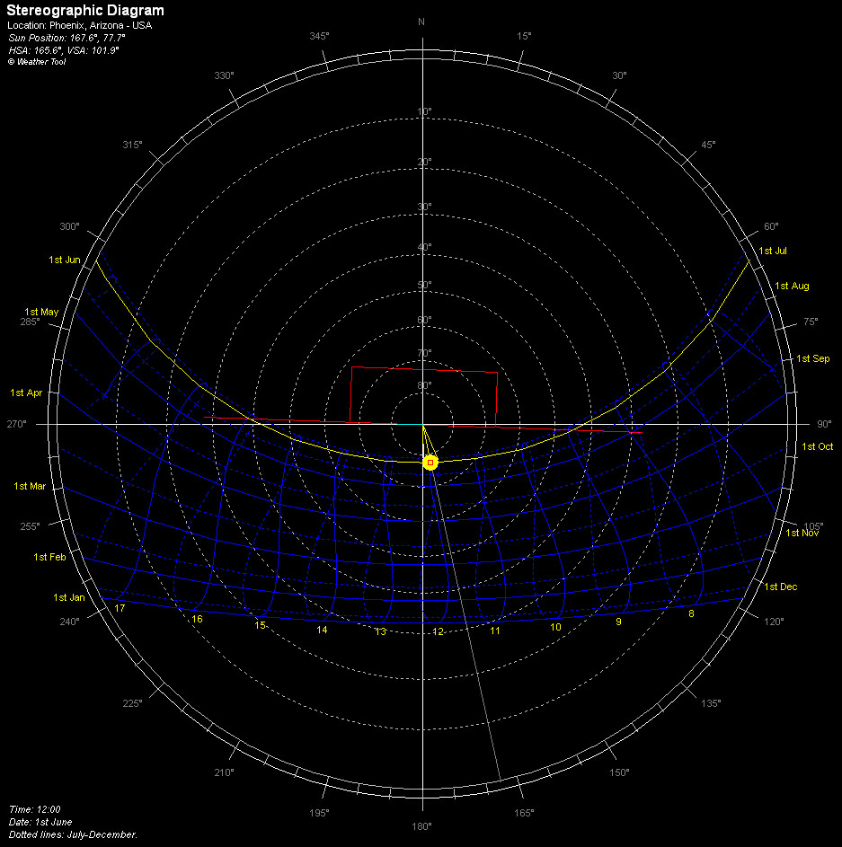
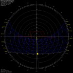
Sun Angle Diagram: Summer and Winter Solstice
Working on a method of representing the sun angles for the Winter and Summer Solstices on the site. These angles are what will eventually guide the parametrics of the roof planes as the pitches shift according to the house location in proximity to the path of the sun generated by Ecotect. More diagrams to follow.

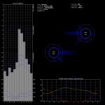
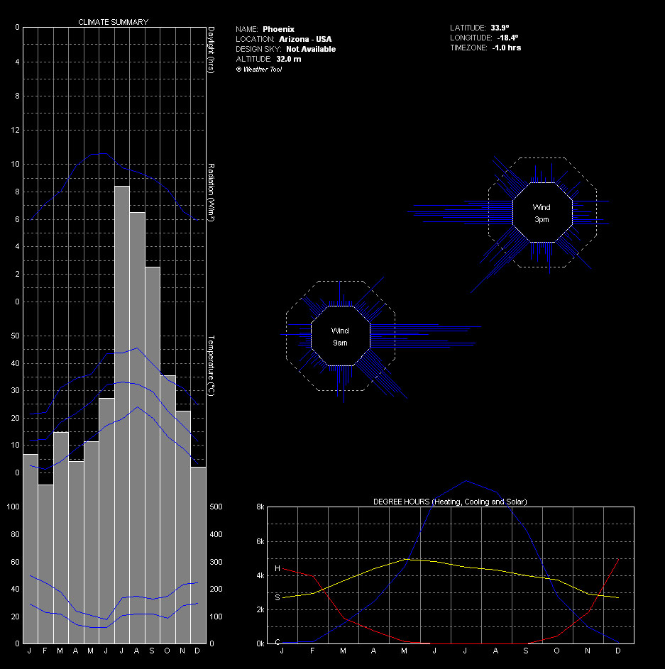
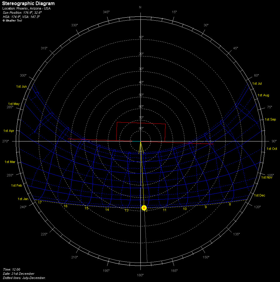
Site Analysis: Ecotect Weather Tool v2
Here are some more useful diagrams pertaining to the wider Phoenix Metro area weather patterns. The data was recorded in 2003 most likely from Sky Harbor Airport. The weather file can be downloaded for free from http://www.ecotect.com/downloads/weatherdata although you will need an Ecotect license to run the analysis. The school labs have them. Enjoy.
-
- Climate Summary
-
- Sun Chart: Summer Solstice
-
- Sun Chart: Winter Solstice
-
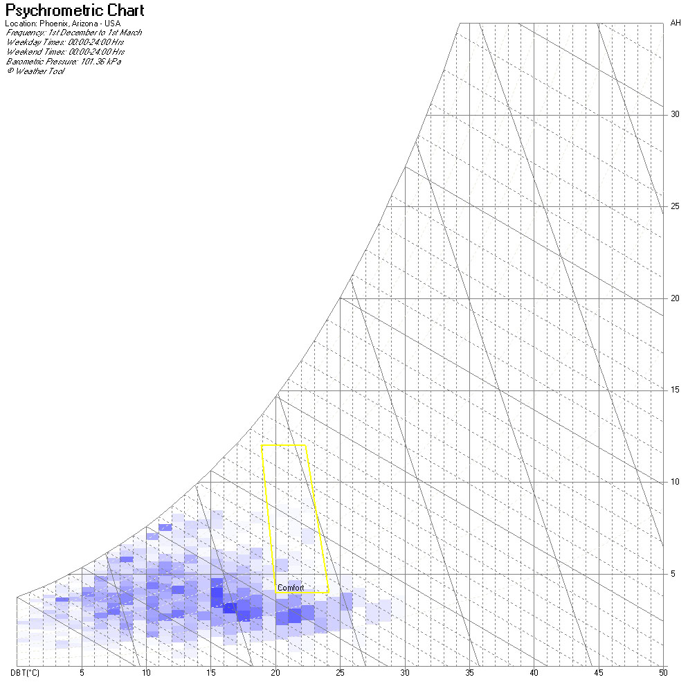
- Psychrometric Chart: Summer

-
- Psychrometric Chart: Winter
-
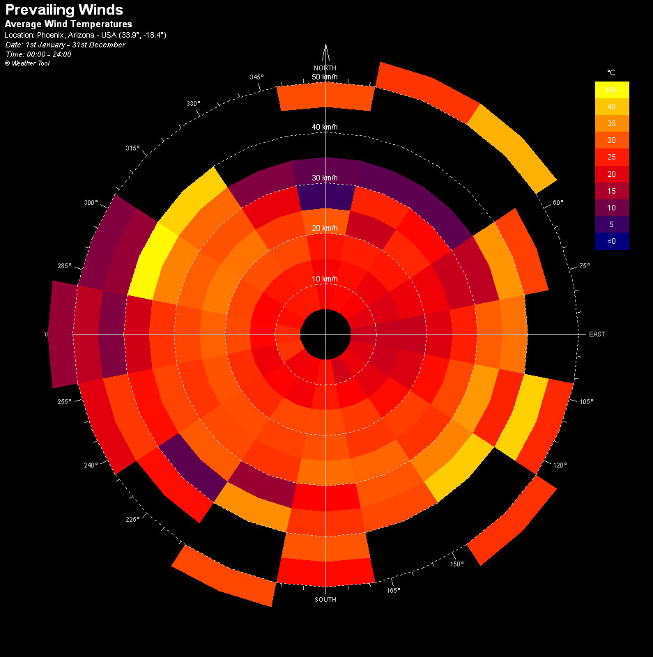
- Avg Wind Temperature
-
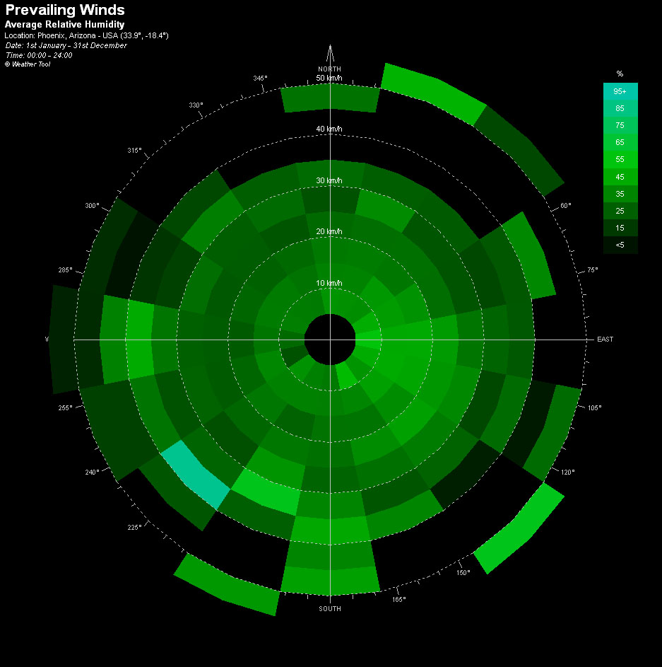
- Avg Relative Humidity
-
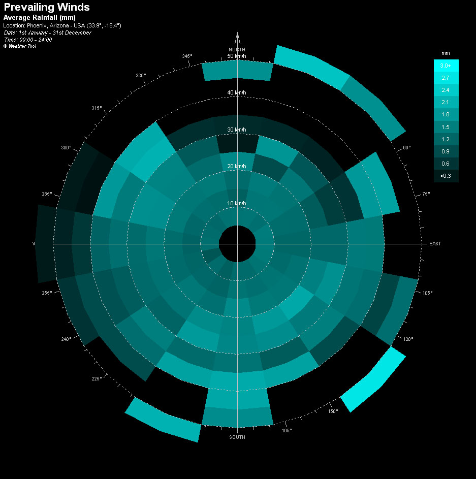
- Avg Rainfall
-

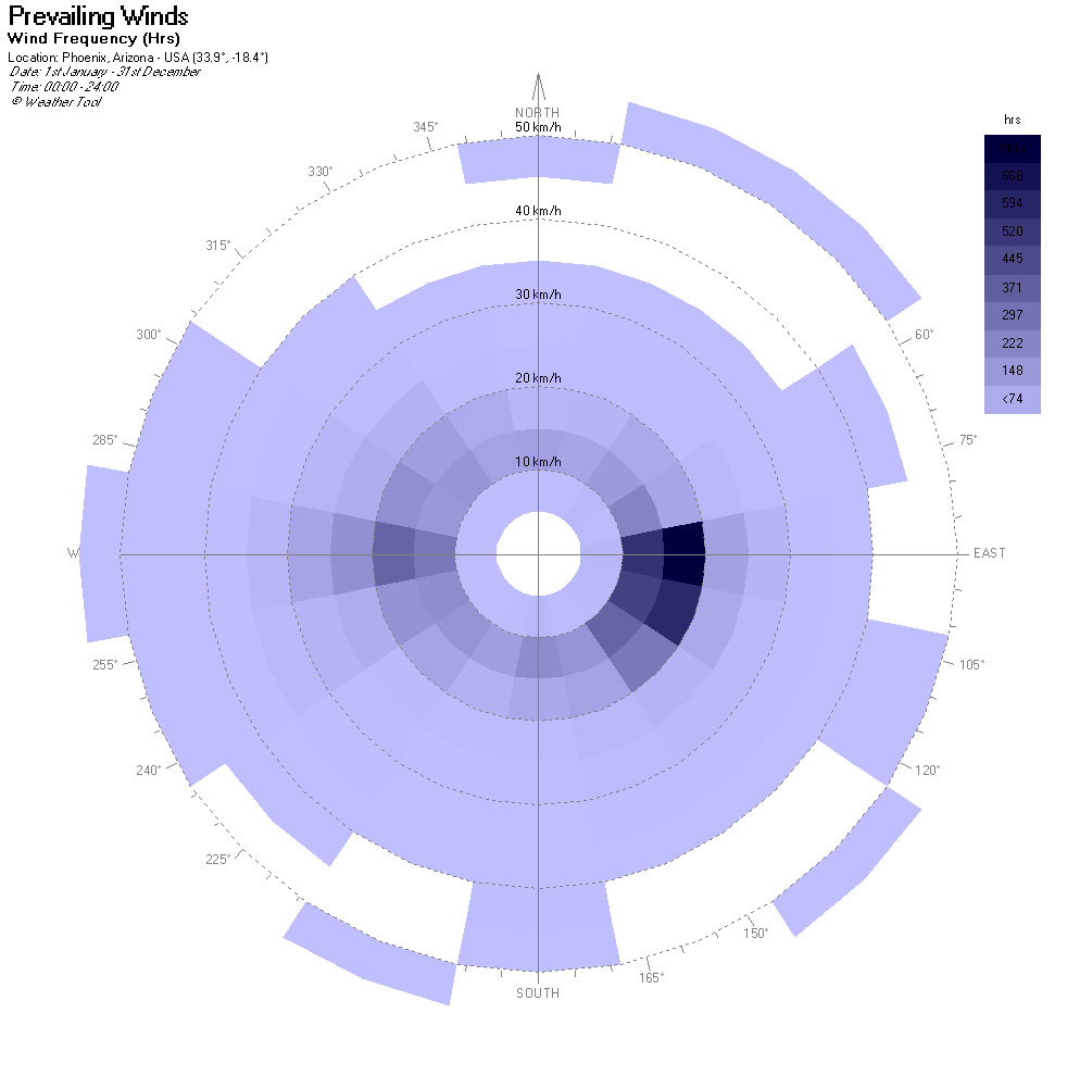
- Wind Frequency
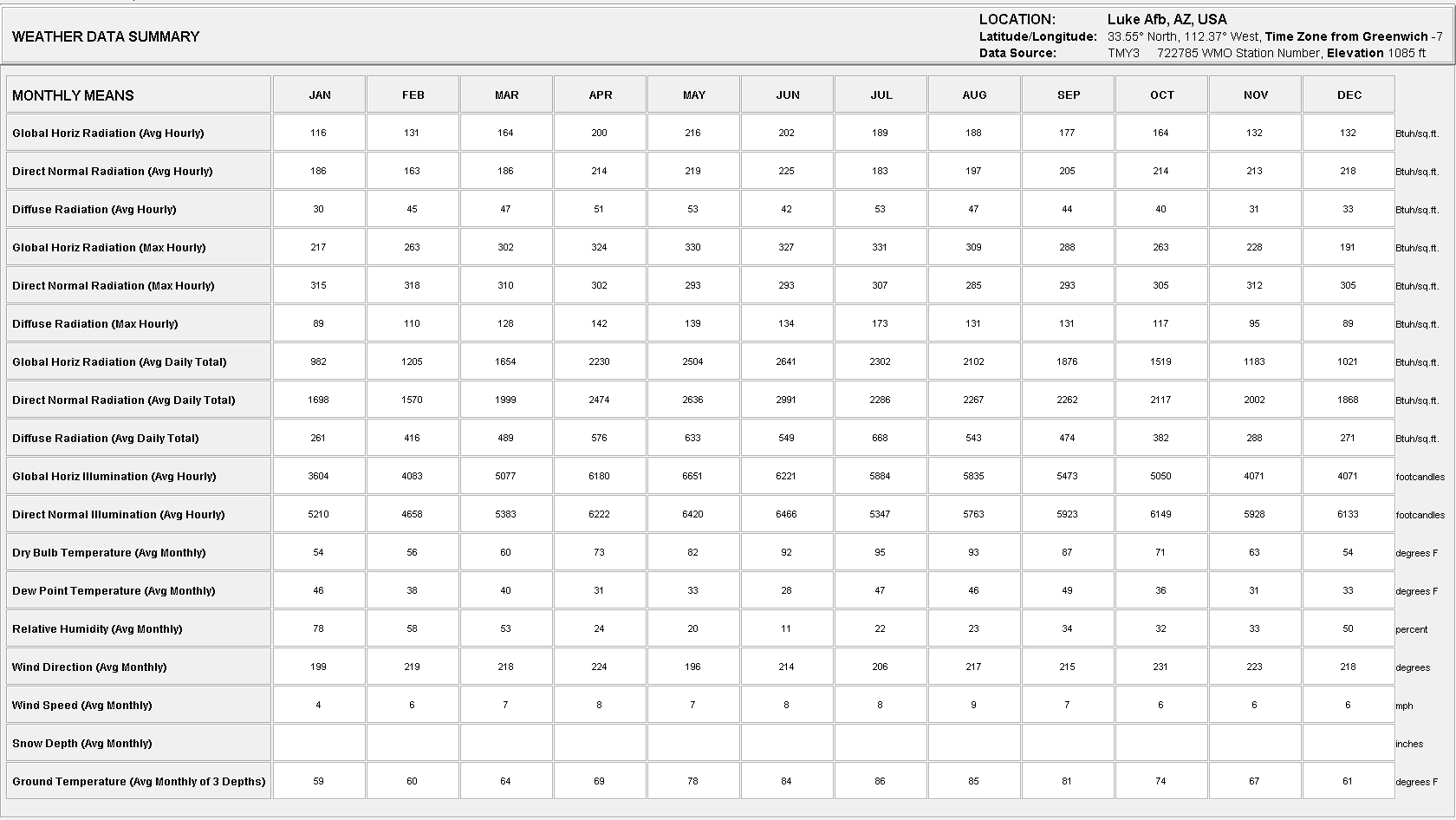
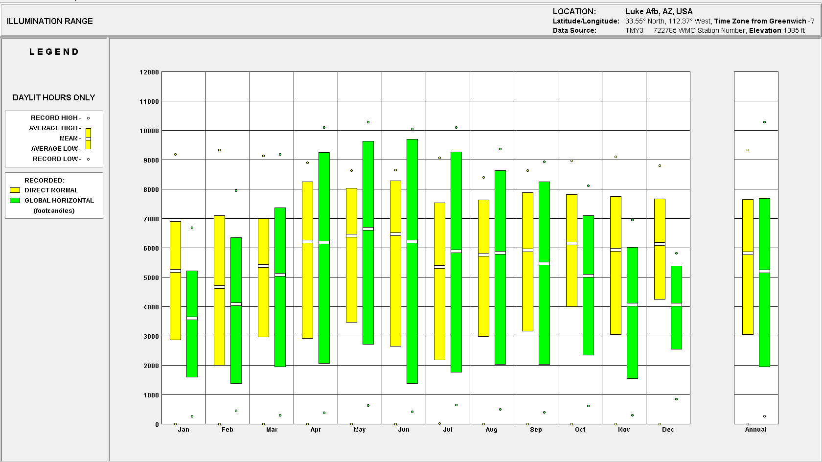
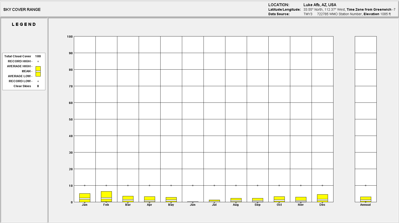
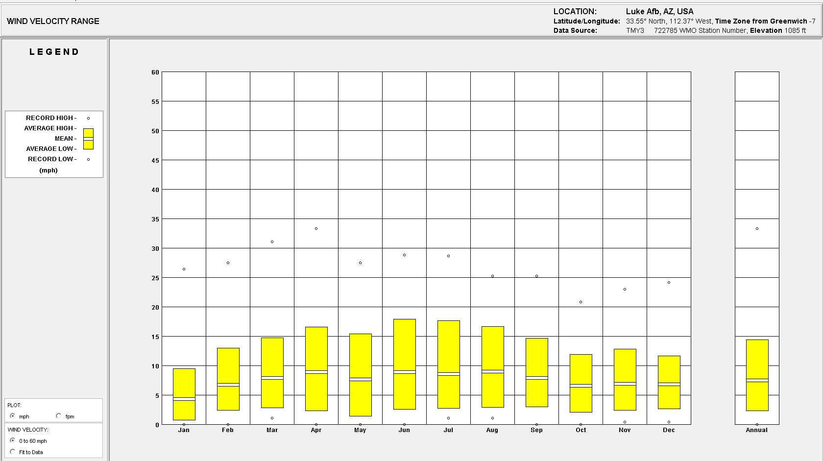
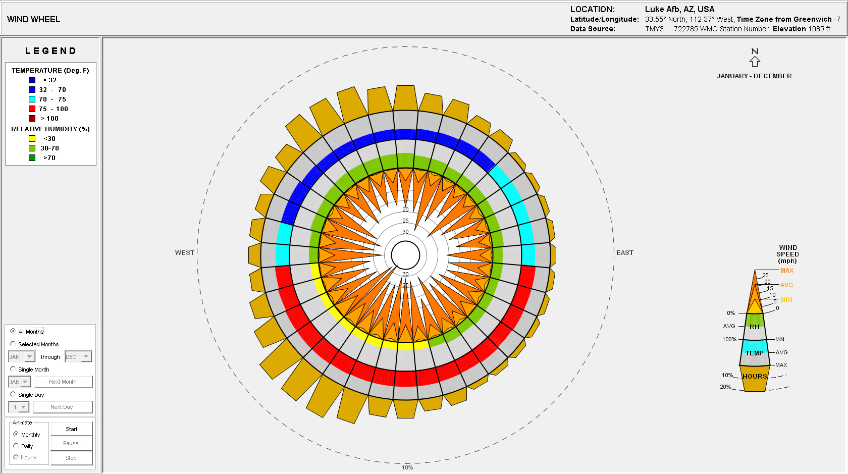
Site Analysis: Climate Consultant 4.0
The .epw file is based on Luke Airforce Base which is located approx. 10 miles west of the proposed site location.


Site Analysis: Historical Aerials

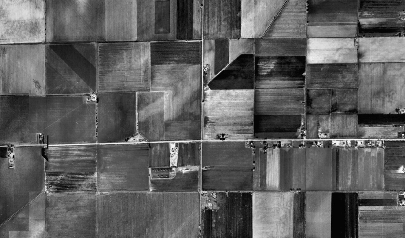

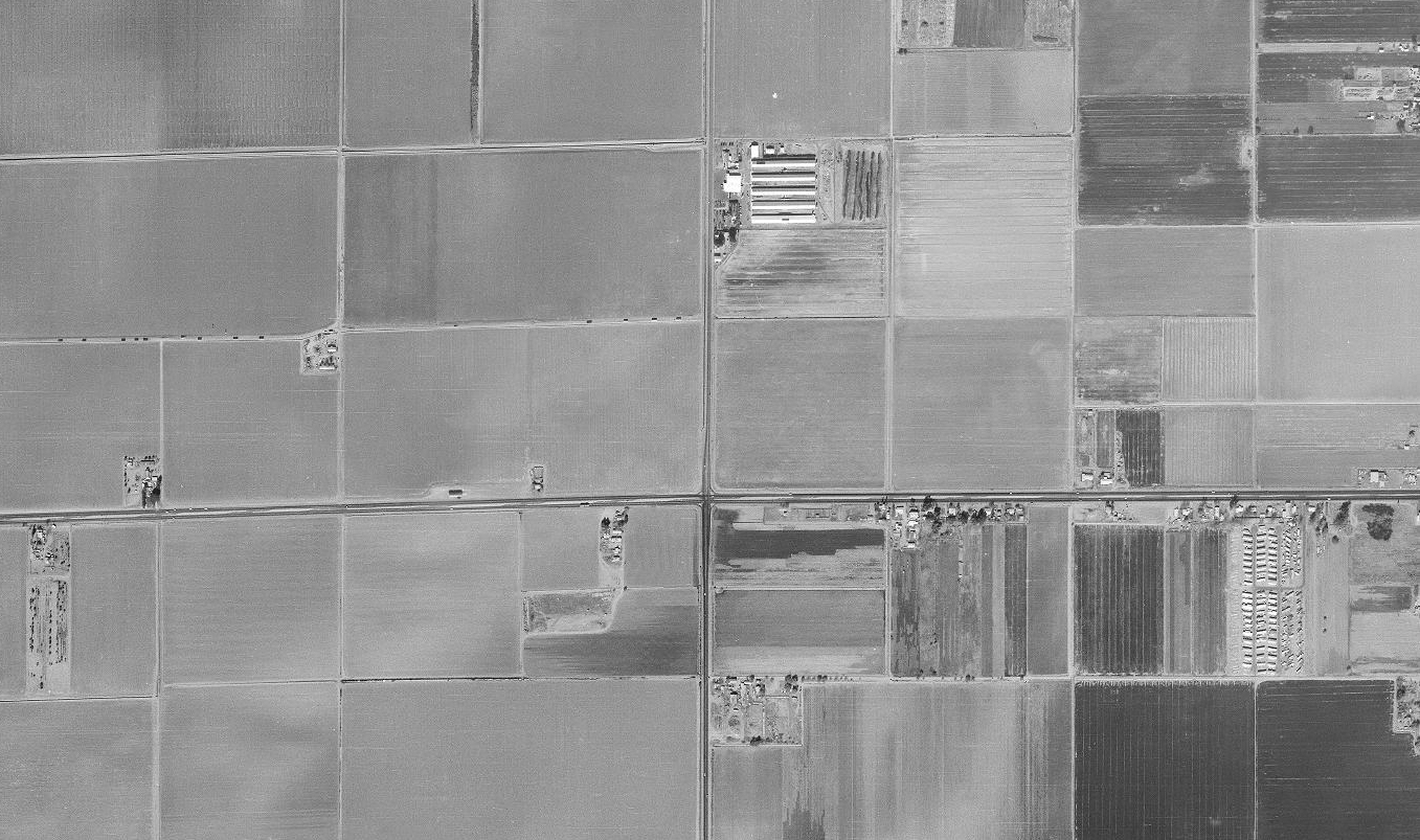
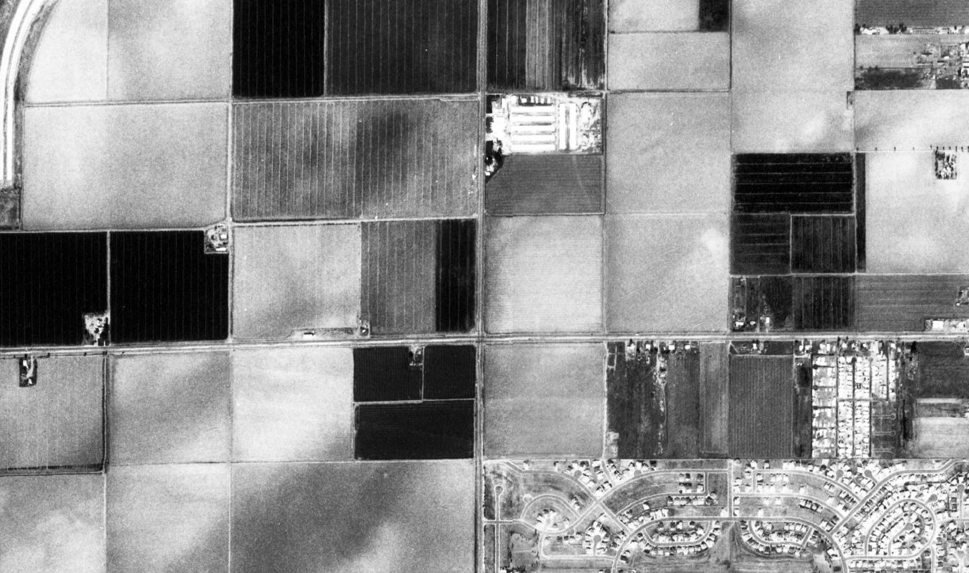

Obtained from Maricopa County GIS Services Website.
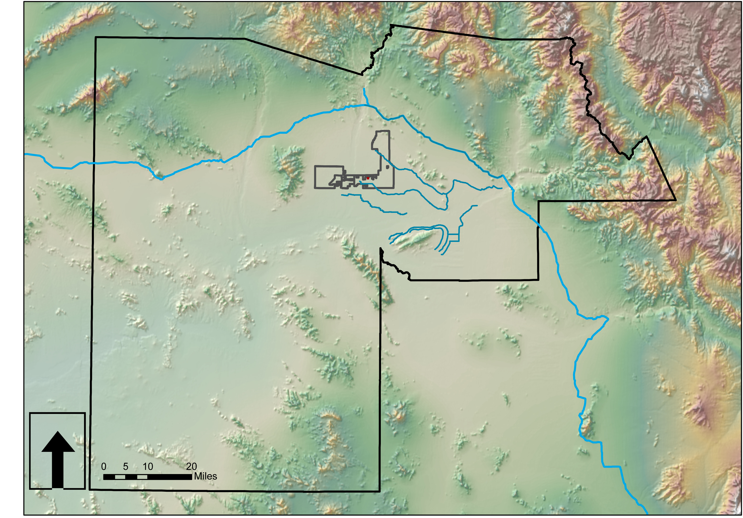
Preliminary Site Analysis: A GIS Survey

Much of the county data is available for download from Maricopa.gov. Look to their GIS services. Perhaps one exists for Pinal County? Below are some context maps of the proposed site location within Glendale. Lastly, I have imported GIS data (.shp files) into AutoCAD Map3D then into SketchUp to begin working on a 3D site model using Google Earth imported images. This takes about an hour from start to finish.


Considering Social Behaviors…
What are common social behaviors that could help inform the re-design of the exurbs? Here, I consider five rudimentary human behaviors including ‘amusement’, ‘complacency’, ‘contempt’, inclusion’, and ‘exclusion’. These are not to be mistaken with innate qualities affecting individuals, but rather those expressed among/between groups of individuals.


